The Mountains of British Columbia
BY: BG EDITOR
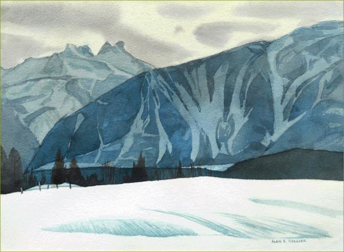
Monashee Mountains
Apr 28, 2018 — GREENWOOD, BC (BG)
Today we present a beautifully tactile description of the mountains of British Columbia, including the Gold Mountain range that encompasses our own Monashee Mountains. The article below, written by Rev. Dr. Herdman and featured in a 1906 issue of the Boundary Creek Times[1], was published shortly after a Canadian Alpine club had been formed, creating a stir of interest in Canadian mountains.
The Reverand Herdman was apparently an intrepid traveler through the mountains of British Columbia. His descriptions offer a simple layman's guide on looking at and understanding something of our mountain terrain: how to judge the height and size of mountains from a distance, navigating their ice-fields and avalanche prone cornices, and appreciating their glaciers, crevasses, rocks slides and hoodoos.
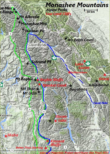
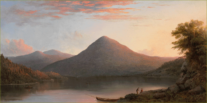
Monashee Mountain Range
(Within the green border)
Greenwood is located in the Monashee Mountains, which are part of the Monashee Range (originally known as the Gold Range). The Monashee Range is situated between the Selkirk Range to the east and the Okanagan Plateau to the west, then further west the Coast Range. The highest elevation in the Monashees is 10,650 ft. (3,246 meters).
While the Monashees have many glaciated peaks, they draw mountaineers for heli-skiing more than for climbing. This is partly due to the shortage of good access trails. There are two favourite climbing areas, however, at Blanket Creek and the Begbie Bluffs. Considered to be well developed for sport climbing, these areas feature sharp quartzite at the Monashee's eastern toes. Also favoured is Kinnard Bluffs, above the Columbia River at Castlegar. Although many consider it part of the Selkirk Range, the Kinnard Bluffs are mapped as being within the Monashee Range.
As they run along the Boundary line, the southern Monashees, Selkirks and Purcells are generally all referred to simply as the Kootenays. While the Selkirks and Purcells continue on south of the border by their range names, the Monashees do not.
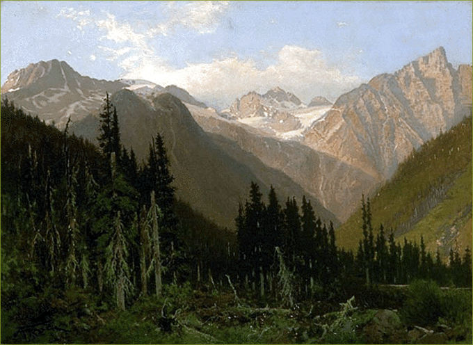
At the Rogers Pass
Painting by John A. Fraser
THE MOUNTAINS OF B. C.
Description of the Main Ranges and Highest Peaks
"Ruskin has written that at the age or two his mother placed him on a crag-summit in the north of England. Peering through the roots of a tree, there flashed into his infant eyes the sight of a wide valley with slanting rays of sunlight and the gleam of far-off distances. Then he woke, in that tender age of his, to a sense of the vastness and loveliness of Nature. Born again into the kingdom of beauty he become an artistic soul. Perhaps we older infants may also see sights and get some inspiration — will one only absorb into our hearts the glow and vision of the great mountain scenery of our Dominion.
Bewildering as our mountains are in variety and number, at least one can count upon four main ranges roughly parallel to the Pacific shore line — the Rockies, the Selkirk, the Gold and the Coast range. Sometimes these two latter are thrown together and named the Cascade. Another range is sometimes suggested consisting of submerged mountains, their tops forming the islands and archipelagos off the Pacific shore. The Rockies are the loftiest, running up often 1,000 feet higher than the Selkirks. Upon the Selkirk range however, moisture falls abundantly, which means many glaciers and large snowfields. There are but few lakes in the Selkirk, the valleys being precipitous.
The Gold range really includes an indiscriminate number of sub-ranges, fairly well flattened down. Some of the Coast peaks rise up straight from sea-level, and in that way (like Cheam, a noble mountain, 70 miles from the month of the Fraser river) really afford a longer climb than from the high peaks of the interior, and present views that alternate between a sea of mountains to the east and a sight of cities along the shore lines of the Pacific. But the difficulty near the coast is how to get through the dense dripping vegetation and timber.
What books are there that deal with our mountains? The literature is charming and fascinating. First, Dr. Green's little volume published in 1888, "Among the Selkirk Glaciers." Mount Bonney was his greatest conquest. Macdonald and Sir Donald were his defeats. But he was one of the pioneer climbers of our mountains, and the mapping of routes, and the studies of rocks and of the glaciers, make the books instructive to this day.
Then came in 1894, Walter D. Wilcox's "Camping in the Canadian Rockies," followed by a later edition named "The Rockies of Canada." Very fine are the photographs given in these books and the author is a man in love with nature and with the climbing of high peaks as well as studying in details of peaceful valleys. In 1904 came out a book of constant climbs and frequent conquests, along with a good deal of the history of the first transcontinental explorers — the authors being H. E. M. Stutfield and Prof. Collie, and the name of the book being "Climbs and Explorations in the Rockies." Another book of perhaps even more added interest, full of poetry and spiritual thought and of long lists of "first ascents," named "ln the Heart of the Rockies," was published last year by an intrepid mountaineer, Rev. James Outram. Then at the end of the year came the magnificent work of our leading Canadian climber and surveyor, "The Selkirk Range," by A. O. Wheeler, of Calgary, the book being published by the department of the interior. His work presents splendid photographs and describes systematically the early explorations and the present survey system and climbing by different parties of a large array of peaks, and is to be followed by maps and charts.
One should refer also to a coming book by Mrs. Henshaw, of Vancouver, on the flora of the mountains, and to the photographs of flowers taken by Mrs. Schaffer. Besides there have been many articles concerning our Canadian mountains published in magazines in the States, especially in the Appalachian Journal, of Cambridge, Mass.
To get a proper understanding of the heights and sizes of the mountains, one must remember that the laws of perspective apply here as elsewhere. A small hill will sometimes hide a large mountain. When you look at the glacier on Mt. Temple, because it is seven miles from the railway, many travellers think it is only a few feet in thickness, it must be at least 200 feet, On the other hand, it is possible that in the early guide books of the C. P. R. the Green Glacier on the east side of Mt. Stephen was rated as entirely too thick, said to be in the early folders 500 feet, which may be an exaggeration, and there were some descriptions that implied that our Canadian peaks were higher than the Alps!
Here is one way of ascertaining the standard that should be applied the mountains: Get first the idea of "tree line," then of the limit of vegetation, then of the slopes of bare rock, then of the glaciers and snow fields, and the cornices that cling to the crest. Trees run up the sides of the mountains to about 7,000 feet in the Rockies and about a thousand feet lower in the Selkirks. Vegetation, in the shape of shrubs, flowers, moss and heath, proceeds from a thousand to two thousand feet higher, when the slopes are not too steep or covered with rocks.
The glaciers in the Selkirks come down sometimes as low as 5,000 feet above sea level. While from the peak of a mountain you get a great panoramic view, yet sometime from a height of about seven or eight thousand feet you can see more detail in the way of lakes ravines, valleys, couloirs — and pick up some good imitations of Scotch heather and capture some gaily colored butterflies.
Beautiful Mountains
Painting by Robert S. Duncanson
Some mountains have different shapes in the same ranges, many of them rising up in an individualistic way; in other ranges they seem to copy the conformation one from another. Fantastic sometimes are the peaked summits, and if a mountain looks monotonous it is because you are not studying carefully the slopes and the curvature of the sides and the whole configuration. The views are finest perhaps, when a great mass rises up steadily and in isolation — like Mt.s Cascade, Castle, Temple, Tupper, Big Chief, or the Three Sisters.
Many eyes seem incapable of discerning the shapings and chisellings of nature's sculpture work — on the line of railway are hoodoos, spires, a horse and rider, a funeral pyre, a hermit and dog, "camels from Egypt," the pyramid of Cheopa, castellated turrets and drawbridges, etc. Many have looked upon the photograph of "The Mountain of the Holy Cross" near Denver, Colorado. This is formed by two deep cracks packed in with snow and ice, with a background of black rocks behind, (but one side of this mountain has now fallen, taking with it one arm of the cross. Southwest from Calgary a different and equally noble cross looms up to discerning eyes; it is on the Banded mountain, and consists of two uplifted ridges of rock intersecting one another, while behind, from the upper part of the cross up to the pyramid peak of the summit, is spread out, throughout almost all months of the year, a background of pure snow.
The steeper a mountain is on one side, the more accessible it usually is from some other side. Mountains have all they can do to maintain their equilibrium and preserve their own peaks! And where a castellated tower or crest rises up, as on the Crow's Nest mountain, and the highest wall of Stephen and the top of Cathedral and other summits — Nature has thoughtfully, in most cases, thrown a ledge around a precipice, and opened up a chimney-crack just at the perilous places.
Many of the mountains have sent down small or large rock slides. A curved peak near Arrowhead threw a mass of debris into the Arrow lake three years ago, which raised a tidal wave that broke the C. P. R. steamer from her moorings at the wharf, and only for the cool headedness and good seamanship of her captain she would have been dashed to pieces or sunk. Near Field, from the slopes of Cathedral mountain, there are visible evidences of a great slide, perhaps second only to the Frank slide. As for this last one, I think Turtle mountain was largely composed of gravel on the side from which the rocks fell, and some other mountains in that neighborhood present the same appearance, the heavy rocks on the surface being apparently a sort of veneering. There are evidences of slides also in the "ice-gorge" on Mt. Stephen and in a valley between Peaks Stutfield and Wooley. A little slope of earth slid right away some years ago at Maple Ridge near Westminster Junction, and last year a small hill moved away at Spence's bridge and buried a settlement of Indians.
What is the height of our loftiest mountains? The highest so far known is Mount Robson, 13,500 feet, west of the Yellowhead Pass. Next to it are Mounts Columbia (12,000), Forbes (12,100), Alberta (12,000). These last named mountains are 50 to 90 miles north of Laggan. Then come Lyell, Athabasca and Assiniboine. The highest mountains visible easily from the railway are Temple (11,637), Stephen (10,523), Vaux (10,741), Sir Donald (10,806), and Bonney (10,700).
Avalanches fall from the cornices and the overhanging glaciers on the mountain crests. In Abbot's pass, between the steep sides of Lefrov and Victoria, great masses are often to be seen, launched out suddenly into space. Then there is a noise like the roar of Niagara, and behind the avalanche streams of snow-dust trail down like cascades. Climbing up the deep side of a high crest you often find a shelf of snow and ice extending over your head for 20 feet or more into space. This needs caution and more caution perhaps, when you are rounding peaks or corners where the snowslope seems firm but has nothing but air beneath it.
As for the glaciers, they move an inch or two on an average each day. Some are steep, others — like the Victoria glacier, near Lake Louise — almost level. The ice is vicious and the snout of the glaciers is usually the most slippery and dangerous part. The reason of this is because the warm air of the valley has effect upon the ice, and the glacier itself is fed usually from a snow field (reve) covering a large area. The reve on the slopes of Mount Columbia is said to include 200 square miles, and in many places, as near Glacier House, the snow fields often connect and combine. In climbing to the great ice-field of Mount Hector, you mount up to a height of perhaps 9,000 feet and reach a high escarpment. The climate seems tropical all the way to divide itself, but the two sides have passed the obstruction and come together again, curving right round the lower rocks. Oh the south side of the Upper Bow lake there is a three- pronged glacier on view, most interesting and weird. There is another fairly similar one in the Yoho valley.
Some glaciers receive many avalanches of stones from the mountain sides which hem them in. On a level glacier you will find flat rocks many feet up in the air, supported by an attenuated pillar of ice. This position is due to their shielding off the rays of the sun. Streams course their way over and through the ice-fields, running into crevases and moulins, and finally emerging from the foot of the glacier, milky in color. This color is due to the steady movement of the glacier pounding down the rocks it carries and grinding them on the rockbed beneath, and sometimes the ice in its slow and earlier journeys has evidently cut away cliffs and undermined ledges and made formidable erosions and gorges. The stones taken down by the glaciers are thrown together into large deposits at the base, called terminal moraines, and on their flanks are piled up lateral moraines. These are worth studying often as to their relative position and size, giving much light as to the receding and melting down of the glaciers.
At the foot of the great Illecillewaet glacier, Dr. Green and Mr. Vaux have put bands of paint upon terminal rocks with dates showing plainly how this ice field is shrinking. But some glaciers, instead of receding, are pushing out into the timber growth and pushing it down. This holds good of a glacier near Moraine lake, and of another in a valley between Stutfield and Wooley Peaks, where the ice is sheltered from the sun by a heavy rockslide. As you climb up the Beaver valley on the C. P. R., looking out across, you see a large range of hills called the Prairie hills. These are probably moraines, formed by a glacier that at one time filled up the valley, and we may conclude that the glaciers which remain are remnants and relics of the Great Ice Age.
The passes are also interesting to traverse. Above the Upper Bow Lake you come to a shoulder whence a striking panorama discloses itself. On one side is the source of the Bow river running past Calgary, on the other side, out of a cavern at the foot of a glacier, runs a swift stream which is the main source of the North Saskatchewan, passing Edmonton, and even on the pass itself, which is a sort of meadow, a little morass covers the summit in wet weather, out of which small streams trickle, one to the Bow, the other to the other river.
And away farther north, near Columbia mountain, on the sides of the Dome, 11,650 feet high, the snow melts at the foot of the glaciers and runs into three different rivers — the Athabasca emptying finally into the Arctic sea; the Columbia, emptying into the Pacific; a branch of the Saskatchewan, emptying at last into the Atlantic via Hudson's Bay.
There is another pass that should be referred to. David Douglas, the botanist stood in a valley between two mountains after coming west through the Yellowhead pass, and these mountains he named Brown and Hooker, and estimated them as 16,000 to 17,000 feet high. And geographers have ever since set down these names and credited them with these altitudes. The pass has certainly been definitely located by virtue of a little circular pool named "The Committee's Punch Bowl," but within the last few years Wilcox, Coleman, Collie and others have visited this spot, and have surveyed the mountains and have found them to be only 9,000 to 10,000 feet in height."
FOOTNOTES:
REFERENCES:
Rock Climbing in the Monashee Mountains
MountainProject.com