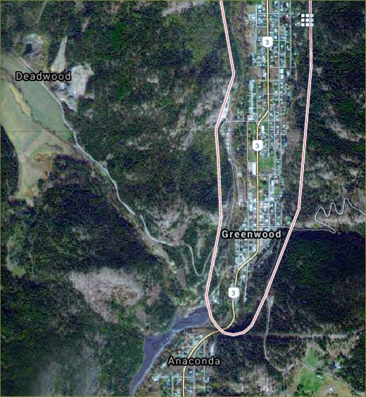
Walking on Greenwood Community Trails
BY: BG EDITOR
BY: BG EDITOR
Mar 30, 2019 — GREENWOOD, BC (BG)
It's that time of year again! Enjoy a springtime walk on one of Greenwood's beautiful hiking trails, cross-crossing the glorious Boundary.
The following descriptions of local hiking, and in some cases mountain biking trails are excerpted from the Boundary Trails Guide and Maps (2003) published by the Grand Forks Chamber of Commerce. Some landmarks (e.g., buildings, colours, etc.) will likely have changed since the time of writing.
Jubilee Mountain Trail and Deadwood Wagon Road
Hike Time: 2 hours
Difficulty: Medium steepness and gradual
Access this trail from Louisa Street in Greenwood. This was where the CPR Station stood, until it was destroyed by a train wreck and fire in 1964. Go up the hill to Togo Street, follow the road until you see a tall red building. Behind this building you will see a sign marked Jubilee Mountain Trail. This trail gradually climbs the west ridge above Greenwood, branching out about 1.5 km. up the hill.
Stay to the left. There are about three switchbacks. You will pass through a wire gate. Please close all gates behind you as this is a ranching area. Soon you will pass by an old mine shaft right beside the trail. Although it is not very deep, do not climb inside.
Further along the trail is a branch to Jubilee Mountain. It is a nice medium climb and offers a great view of Greenwood and Anaconda at the top. From here you may want to descend the trail and end up on the Motherlode Road above the Greenwood Smelter. If you want, you can descend the original trail and follow this one back to the Motherlode Road. This will bring you out to the 2 km. mark of the Motherlode Road. Lower down you will see the old railroad grade from the Motherlode spur of the CPR.
Paralleling Motherlode Creek, this trail/grade will take you back to the Greenwood Smelter smokestack, and if you stay on the grade it will take you back to the Greenwood Station grounds on the Trans Canada Trail. Done in reverse, this tour makes a great 1 hour mountain bike trip with little technical expertise needed as the trail is wide.
Tramway Bore and Viewpoint
Hike Time: Approx. 1 hour (one way)
Difficulty: Very steep
At Highway 3, take Berta Street as far as it will go, turn left and ascend to the Greenwood Phoenix Tramway Bore. Do not enter! There are dangerous gases and possible falling rocks. The trail is marked at the trailhead. It is a wonderful trail for hiking but is very steep for mountain bikes and has many sharp switchbacks. This trail takes you along the line of the tramway bore and past a couple of mineshafts and the remains of an ancient miner's cabin. This takes you to a spectacular view of Greenwood marked by a Canadian flag. In the spring and early summer be sure to check for woodticks.
Lind Creek Reservoir Trail
Hike Time: Approx. 1 hour (total)
Difficulty: Moderate
Starting at the Greenwood Post Office, turn right on Lind Creek Rd. (Skylark St.) Stay on the road about 2 km., cross a cattleguard and about 100 m. further on the right you will find a trail descending to the Lind Creek Reservoir. Descend then follow the trail uphill to the reservoir. To leave, follow the trail downhill to Anaconda. A great spot to watch birds and wildlife. Please do not swim in the reservoir!
Phoenix Wagon Road
Hike Time: Unconfirmed
Difficulty: Incomplete and rough, steep and constant climb
From the Post Office in Greenwood, follow the Phoenix Road to the first crossing of Twin Creek. The sharp bend is the trail head. The Old Wagon road followed Twin Creek originally, but the first 1.5 km. has been roughly cleared. At a fence blocking the original trail you will see a trail that climbs steeply to the right. (The original road followed Twin Creek and hopefully it may be open for recreation in the next few years.) Follow the new trail to the top where it branches. Stick to the left and it will parallel Twin Creek until you return to a forest service road. To return to Greenwood, follow the road back to the paved Phoenix Road and into Greenwood.
Boundary Creek Nature Walk
Hike Time: Unconfirmed
Difficulty: Easy, but can be rough and overgrown at times
This trail parallels the Trans Canada Trail and Boundary Creek. It is a nice place to watch for birds and wildlife. Please be respectful of all wildlife. This trail can be rough and overgrown at times.
Access can be obtained from various points in Greenwood:
1) from the trestle by the old West Kootenay Power Building;
2) at Deadwood Street where it follows the alley from the skating rink to Louise Street, passing Ohairi Park, the City Park and the Kettle Valley Lions Park and playground;
3) crossing Louisa Street it parallels Boundary Creek to Berta Street behind the Boundary Creek Motel. Parts of this trail are very rough and caution should be exercised; and
4) Another branch of the trail starts north of Louisa Street on the Trans Canada Trail and follows the creek to an orange pedestrian bridge one block from the Greenwood Elementary School. A nice amble back up the hill joins you with the Trans Canada Trail.